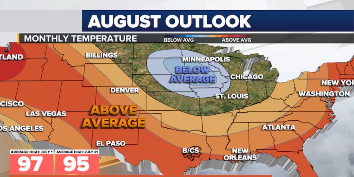
August temperatures are predicted to be above average across much of the nation, with higher chances of showers and thunderstorms in the Southeast and mid-Atlantic.
From coast to coast, August is usually the second-warmest month of the year, with considerable precipitation in the Southwest and Southeast. However, if the most recent forecasts are accurate, there will be some significant variations from normal months.
For example, the prognosis indicates enhanced precipitation chances from the mid-Atlantic to the Gulf Coast, but it does not point to a very active monsoon pattern throughout the Desert Southwest.
Although this would initially seem to be the outcome of a possible tropical system, a deeper look at the outlook suggests that shower and thunderstorm activity unrelated to an organized cyclone may be more likely to be responsible for the enhanced rainfall.
Though precise effects from any tropical activity would be shown in shorter-term forecasts rather than the monthly outlook, the prospect of a tropical system increasing rainfall throughout the region cannot be completely ruled out.
Regretfully, the anticipated trend indicates that there will likely be minimal drought relief in many drier regions of the nation, especially in the Western U.S.
Because of changing phenomena like the El Niño–Southern Oscillation (ENSO) and the Madden-Julian Oscillation (MJO), forecasters say the precipitation outlook for August is more unpredictable than the temperature outlook.
Weather from the tropics into the subtropics can be greatly influenced by the MJO, an eastward-moving pulse of intensified convection that circles the world along the equator.
Forecasters can determine whether a location is more likely to see higher storminess or drier-than-normal weather by looking at the MJO’s state.
Temperatures, which are predicted to remain warm for most people through the end of the month, can also be significantly impacted by precipitation patterns.
Although it frequently results in higher humidity levels, persistent rainfall can decrease midday highs and lower thermometer readings.
Read Also: Dangerous Heat in DC Friday: Index Could Hit 109°F Between 11 a.m. and 8 p.m.
The Northeast, Rockies, and Pacific Northwest—regions that are probably controlled by powerful ridges of high pressure—have the best potential of experiencing temperatures above average.
It is possible that the summer will rank among the hottest seasons in North America, depending on how warm August ends up being.
According to NOAA data, the summers of 2021 and 1936 are currently the warmest in U.S. history, with national average temperatures rising by almost 3 degrees Fahrenheit above normal.
With a mere 0.2 degrees Fahrenheit difference, the summer of 2024 came very close to breaking those records.


