Chicago, IL — Though winter is still 40 days away, much of the United States is already feeling its first major Arctic blast, with record-breaking cold, heavy lake-effect snow, and historic early-season freezes sweeping from the Upper Plains to the Gulf Coast.
Meteorologists say the event is fueled by a massive wave of Arctic air plunging southward, bringing conditions more typical of January than early November.
Midwest Hit by Early, Intense Snowfall
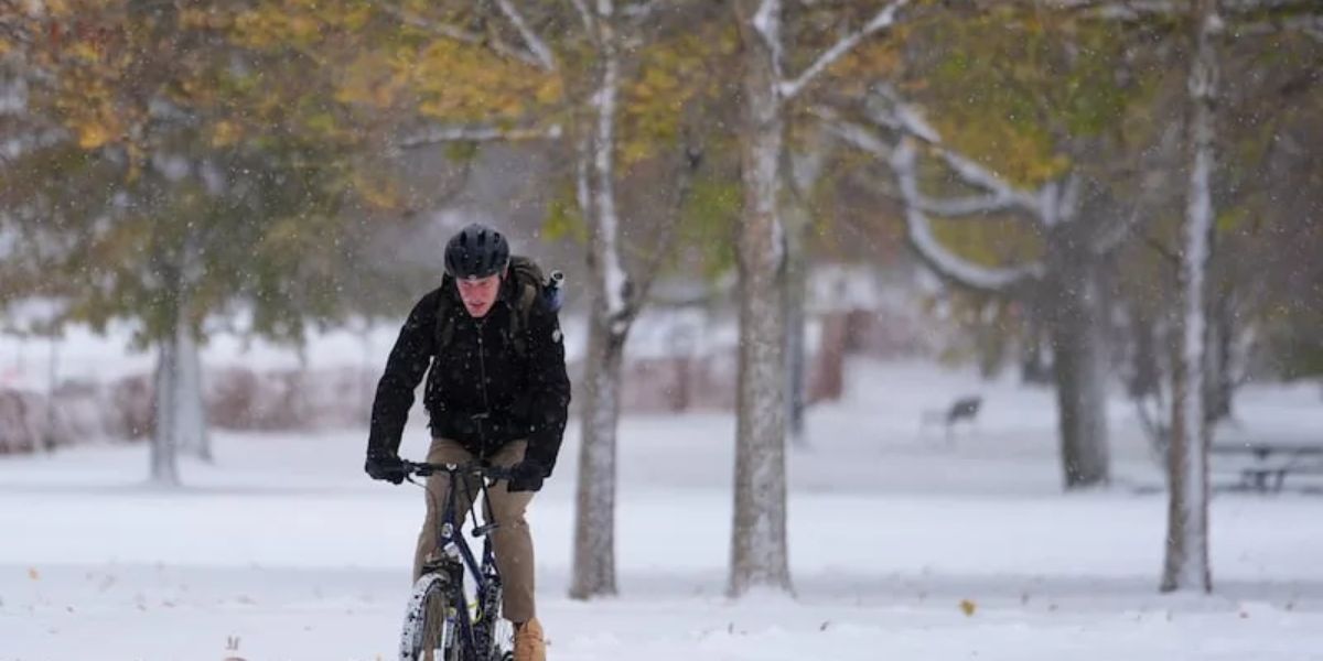
Snow began falling over the weekend in Chicago, with flurries intensifying across Northwest Indiana and Michigan’s Upper Peninsula. By Monday, some areas saw snowfall rates as high as three inches per hour, and totals had already surpassed a foot in the hardest-hit zones.
“For some of the major metro areas in the Midwest and Great Lakes, this snow is coming way earlier than average,” said AccuWeather senior meteorologist Chad Merrill.
Typically, Chicago’s first inch of snow doesn’t arrive until around January 17 — meaning this storm came more than two months early.
The National Weather Service reported that additional snow bands were forming across northeast Ohio, northwest Pennsylvania, and southwest New York, while lighter snow showers were expected as far south as Kentucky, West Virginia, Tennessee, and even parts of the Carolinas by Tuesday morning.
Record-Breaking Freeze in the South
It’s not just snow. Cities across the Southeast are bracing for some of their coldest early-November temperatures in decades.
“This cold snap is exceptional not just for how early it is, but for how deep into the South it reaches,” forecasters said.
Residents in Birmingham (AL), Baton Rouge (LA), Savannah (GA), and Jacksonville (FL) could wake up to temperatures in the 20s and 30s, with widespread freeze warnings in effect.
- Melbourne, Florida may record its earliest day below 60°F since records began more than 85 years ago.
- Atlanta is forecast to plunge from 70°F on Sunday to 27°F by Tuesday morning.
- Charlotte and Winston-Salem, North Carolina, could even see brief snow showers overnight Monday.
The Science Behind the Arctic Blast
Meteorologists point to a collision of two key weather systems behind this unusual early freeze. The first is a polar jet stream that dipped sharply southward from Canada, sending Arctic air across everything east of the Rockies.
The second factor is the lake effect — a phenomenon triggered when that frigid air passes over the still-warm waters of the Great Lakes, collecting moisture and dumping it as snow when it reaches land.
“The Great Lakes act like steam engines when cold air moves over them,” explained a National Oceanic and Atmospheric Administration (NOAA) forecaster. “That moisture rises, cools, and then falls as intense, narrow snow bands.”
Typically, lake-effect snow falls within about 25 miles of shore, but strong winds can push it as far as 100 miles inland.
Travel Impacts and Power Disruptions
In Northwest Indiana and areas south of Chicago, wind gusts up to 50 mph combined with double-digit snow totals made for hazardous driving conditions Monday. Stranded motorists were reported along Interstate 57, and hundreds of flights were canceled at major airports, including O’Hare International.
Numerous school districts announced closures, and road crews worked around the clock to clear major highways.
Brief Cold Snap Before a Rebound
Fortunately, forecasters say this wintry preview will be short-lived. As the jet stream begins to retreat northward, temperatures across the Midwest and Central U.S. are expected to rebound quickly on Tuesday. Most of the East Coast will also see milder conditions return by Wednesday.
“It’s a reminder that winter is coming, but not quite here to stay,” Merrill said.
What are your thoughts on this early winter blast hitting so many states? Share your experiences and local weather updates in the comments below.


