In an attempt to increase uniformity and public awareness of flooding threats, the Charleston, South Carolina, office of the National Weather Service will shortly be introducing new standards for issuing Flood Advisories and Flash Flood Warnings.
During a press conference on Tuesday, officials revealed the modifications, which they said are intended to bring Charleston’s warning system into compliance with national guidelines and improve communication with possible flooding hazards.
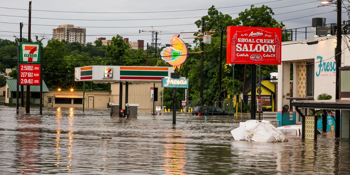
According to the revised standards, some higher-end flooding events will now qualify for a base-level Flash Flood Warning, whereas previously, some low-end flooding events in Charleston frequently result in a Flood Advisory, a lower-level alert.
Residents may notice more warnings and fewer advises as a result of the adjustment, especially in metropolitan areas where roads and drainage systems are vulnerable to flooding.
The agency has issued about 95 advisories and 19 flash flood warnings in the last year; these numbers could practically change once the new policy takes effect in August.
Officials stressed that the modifications are intended to better convey the gravity of occurrences rather than to represent an elevated danger.
“This does not make Charleston more flood-prone,” stated Charleston County Emergency Management Director Justin Pierce. “It just means the public will get clearer, more actionable information.”
Although there will be more warnings for the public, Pierce pointed out that first responders have no plans to alter their present reaction strategies in any way.
Furthermore, there will be no changes to the requirements for a Flash Flood Emergency, which is the highest degree of warning.
As more “nuisance flooding” has become a weekly occurrence, the city has experienced more than a fourfold rise in flooding episodes over the last 30 years.
The fact that tidal flooding, which causes a large portion of lowland flooding days, will continue to be notified through products like Coastal Flood Warnings and Storm Surge Warnings rather of any kind of Flash Flood product is one important issue officials emphasized.
“Why are we making this change? We’re trying to better articulate. Better trying to communicate the impacts of flash flooding,” said Brian Haines, meteorologist-in-charge of the Charleston, South Carolina, NWS office.
Haines went on to say that he hopes the phrase won’t obscure the methods that the public should be informed via television, social media, and other channels.
One possible candidate for future adjustments was the NWS office that covers the Raleigh-Durham metro area in North Carolina.
Read Also: Cleveland Braces for 104°F Heat Index Thursday as Extreme Heat Grips I-77 Region
In a similar vein, neighboring NWS offices in Florida and North Carolina on the East Coast stated that they were just informed of Charleston’s alterations during an unplanned press conference and that no changes were scheduled to arrive at their offices.
In an attempt to improve uniformity in the way we distribute our flood and flash flood products, the present modification is only occurring at the Charleston, South Carolina, Weather Forecast Office.
The agency’s Flash Flood Program lead said in a statement, “We constantly evaluate our services across the country to make sure we’re giving communities accurate and timely information when flooding threatens.”
Officials stressed that the revised procedures have been in the works for more than a year and that they are not a reaction to the devastating flooding that occurred in Texas in July, which killed at least 136 people.


