After a refreshing stretch of cool, dry weather, thanks to high pressure and lower humidity, the last two days have felt more like early fall than the heart of summer.
But that comfortable trend is about to change, as a shift in the weather pattern brings back summer heat—and the potential for showers and thunderstorms by the weekend.
Rising Heat Ahead of a Weak Front
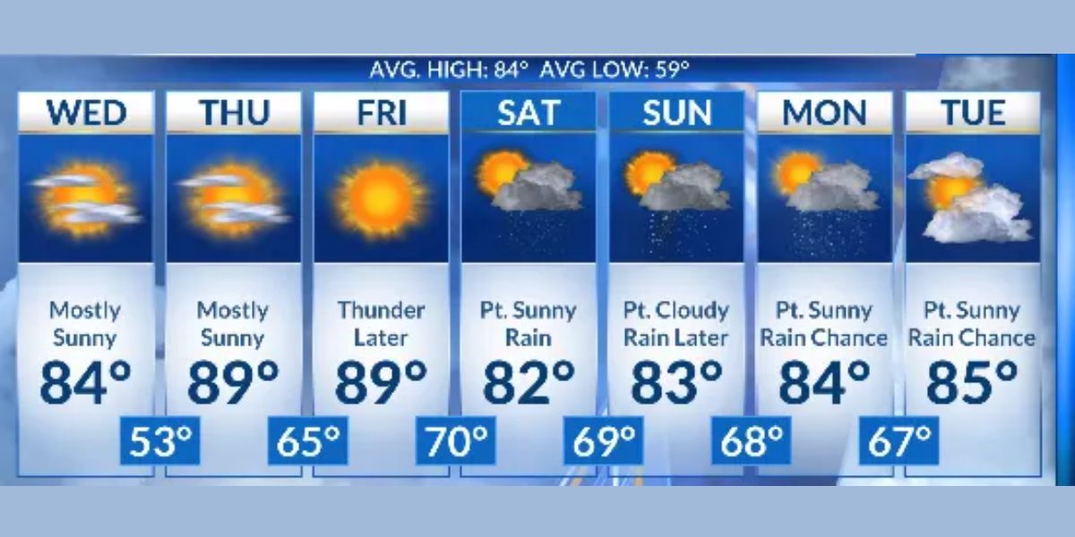
The first noticeable change will be the return of summer-like heat on Thursday and Friday. Temperatures will rise steadily through the end of the workweek, and the added humidity will make it feel even hotter.
Conditions will become increasingly unsettled by Friday evening, as a decaying cold front approaches the region.
While this front is weakening, it will still interact with the hot, humid air in place, providing just enough lift in the atmosphere to trigger scattered showers and thunderstorms.
Read Also: Weeklong Cloud Cover in Store for Chippewa County, Forecast Shows
Most of the storms are expected to remain below severe limits, but the possibility of locally heavy downpours and brief gusty winds cannot be ruled out. A few isolated thunderstorms could pop up during the late afternoon and early evening hours.
Weekend Outlook: Dry Start, Wetter Finish
Looking ahead to the weekend, Saturday appears to be the better day for outdoor plans, with mainly dry conditions expected and only a slim chance for a stray shower.
Sunday, however, brings a different story. A stronger front is forecast to move into the area, increasing the likelihood of widespread showers and possibly a few embedded thunderstorms.
Rain could be steady at times, especially in the afternoon and evening, potentially disrupting any late-weekend activities.


