For many people who have had enough of the Northeast’s never-ending days of high humidity and skyrocketing temperatures, a brief respite is imminent with the arrival of the weekend.
Many parts of the mid-Atlantic, central Appalachians, and southern New England have experienced relatively high humidity levels since the middle of June, with only a few days when the weather was suitable for working outside or exercising.
A few more respites from the humidity helped New England fare a little better.
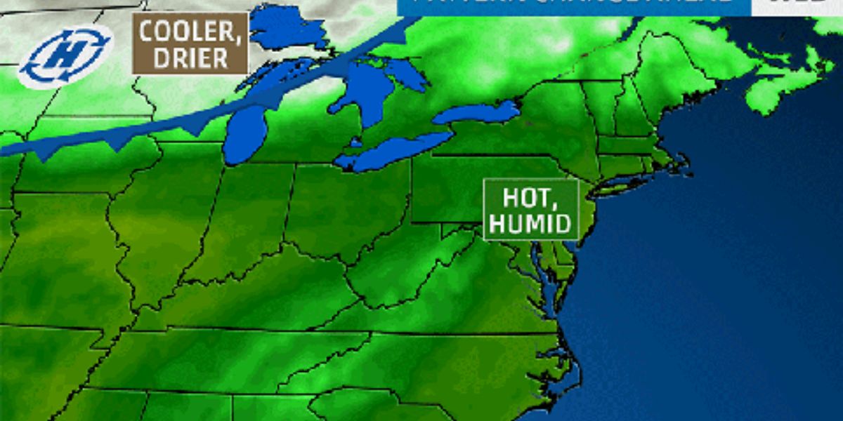
The northern Plains were the focal point of a significant batch of cooler, less humid air that AccuWeather meteorologists are monitoring at the middle of the week.
Tuesday night saw nighttime lows in the 50s and 60s F from the Dakotas to Minnesota.
As the air mass cooled even more on Wednesday night, temperatures in many places dropped into the 40s, and in some places, they even hit the upper 30s. This modified air mass will be guided to the Northeast by jet stream winds to end the week.
The cool air mass will be impacted by strong mid-July sunshine by the time it reaches the Northeast on Saturday and the Great Lakes on Friday.
Even those who long for summer conditions may be happy because the humidity levels are significantly lower than they were during the time span, which in some places lasted weeks.
Although Saturday’s highs in the Northeast will mostly be in the 80s, which might not seem like much, some people may find it cool in the shade due to the lower humidity and possibly a breeze.
Temperatures will drop to their lowest points in weeks on Friday night in the central Appalachians and the eastern Great Lakes, and on Saturday night in New England and the coastal mid-Atlantic.
The mid-Atlantic Interstate-95 will see lows in the 60s to nearly 70s, while parts of the interior Northeast will experience lows in the 50s and 60s due to the full extent of the cool air.
The temperature and humidity levels will drop, and the atmospheric conditions that lead to flooding downpours will be temporarily removed.
Over the Ohio Valley, southern Appalachians, and the lower mid-Atlantic, the temperature and humidity drop will be less pronounced or nonexistent because the cool air mass will be moving more east-southeastward than south-southeast.
There might not be a break for a large portion of this zone until the end of the month or perhaps even in August.
In Bradford, Pennsylvania, for instance, Friday night temperatures will drop well into the 50s; in New York City, they will drop into the upper 60s; and in Boston, they will drop to the mid-60s. However, in Washington, D.C., temperatures may find it difficult to fall below 80 degrees.
The middle of July is usually a short time for relief from heat and humidity, and this break won’t be any different. Over much of the Northeast, expect humidity levels to rise on Saturday and Saturday night and Sunday in the Midwest.
The Northeast as a whole will have the best chance of having dry weather for outdoor plans on Saturday.
The likelihood of flash floods, thunderstorms, and rainy showers will all increase in tandem with the increase in humidity during the second half of the weekend.


