Around the Coastal Empire and Lowcountry, Thursday was hot and muggy.
Most places saw afternoon highs in the lower 90s, but occasionally the heat index reached over 105°F.
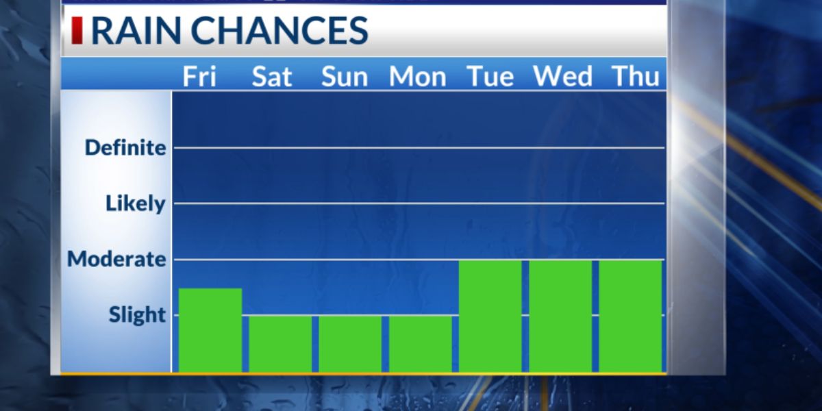
Some lucky spots experienced a brief cooling effect from a few storms and showers. Particularly through the weekend, there will likely be more heat and humidity.
Friday through next week, the primary weather story will be the heat.
Since high pressure is forming over the area, there won’t be much chance of rain or storms over the next few days. Friday’s heat index will be above 105°F, with afternoon highs in the mid-90s.
For some inland communities, the actual air temperature will reach the upper 90s or even 100°F this weekend, making it even hotter. Throughout Saturday and Monday, there will be periods when the heat index is above 110°F.
Recall that the heat index represents the sensation of heat on your body. The more humidity there is, the more difficult it is for your body to cool down.
Make sure to drink lots of water, take frequent breaks, and try to spend as much time as you can inside or in the shade.
Read Also: High Heat, High Humidity Linger in Northeast With Relief Possible Soon
Limiting physically demanding outdoor activities to the cooler morning and evening hours is a smart idea for the coming days.
By Tuesday of next week, there will be a greater chance of rain and storms. We should be in the lower 90s this time of year, which is where more rain will result in slightly cooler afternoon highs.
The average or typical mid-July afternoon high in Savannah is 93°F. In July of 1879 and 1986, Savannah recorded its highest temperature ever, which was 105°F.
Right now, there is very little chance that the system in the northern Gulf will develop into a tropical storm or depression.
It has been traveling along the northern Gulf Coast, which has limited its ability to organize.
Right now, this disturbance is merely a heavy rain maker over eastern Louisiana. It has rained more than eight inches in many parts of southern Louisiana in the last two to three days.
Over the next five to seven days, there won’t be any more developments in the Atlantic basin.


