The eastern part of Iowa is experiencing a scorching heat wave on Thursday, July 24, with heat indices reaching well above 100 degrees Fahrenheit by the time storms come overnight.
According to the National Weather Service in the Quad Cities, a Heat Advisory will continue to be placed in force from ten in the morning until seven in the evening on Thursday.
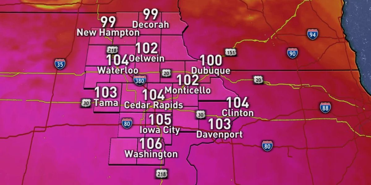
There will be temperatures in the low 90s, but the humidity will cause heat index values to reach as high as 105 degrees Fahrenheit, particularly in the vicinity of Davenport and along Interstate 80. Residents should limit their time spent outside, drink plenty of water, and be sure to check on their neighbors who are vulnerable.
After ten o’clock on Thursday evening, showers and thunderstorms are expected to develop, and some regions may have heavy rainfall and gusty gusts along with them.
Localized pockets may have rainfall totals that are greater than half an inch, and the risk for severe storms is still low but not completely absent.
In the evening, commuters and travelers along Interstate 74 and U.S. Route 61 should be prepared for roads that are slick and visibility that is decreased.
In the vicinity of Marengo, flooding is still occurring along the Iowa River, and flood watches may be extended if the rainfall occurs in greater quantities.
A Look Ahead: The Forecast for the Next Five Days in Davenport, Iowa
| Day | Date | Daytime Forecast | Nighttime Forecast | High / Low |
| Thursday | July 24 | Hot, heat index up to 105°F | Thunderstorms likely after 10 p.m. | High 91°F / Low 73°F |
| Friday | July 25 | Chance of storms before 1 p.m., then clearing | Showers likely again Friday night | High 84°F / — |
| Saturday | July 26 | Partly sunny with scattered storms | — | High 87°F / — |
| Sunday | July 27 | Sunny and hot, continued summer heat | — | High 92°F / — |
| Monday | July 28 | Mostly sunny and humid | Mild night, low around 73°F | High 91°F / Low 73°F |
It’s possible that we’ll see another bout of heat and scattered storms early the next week.


