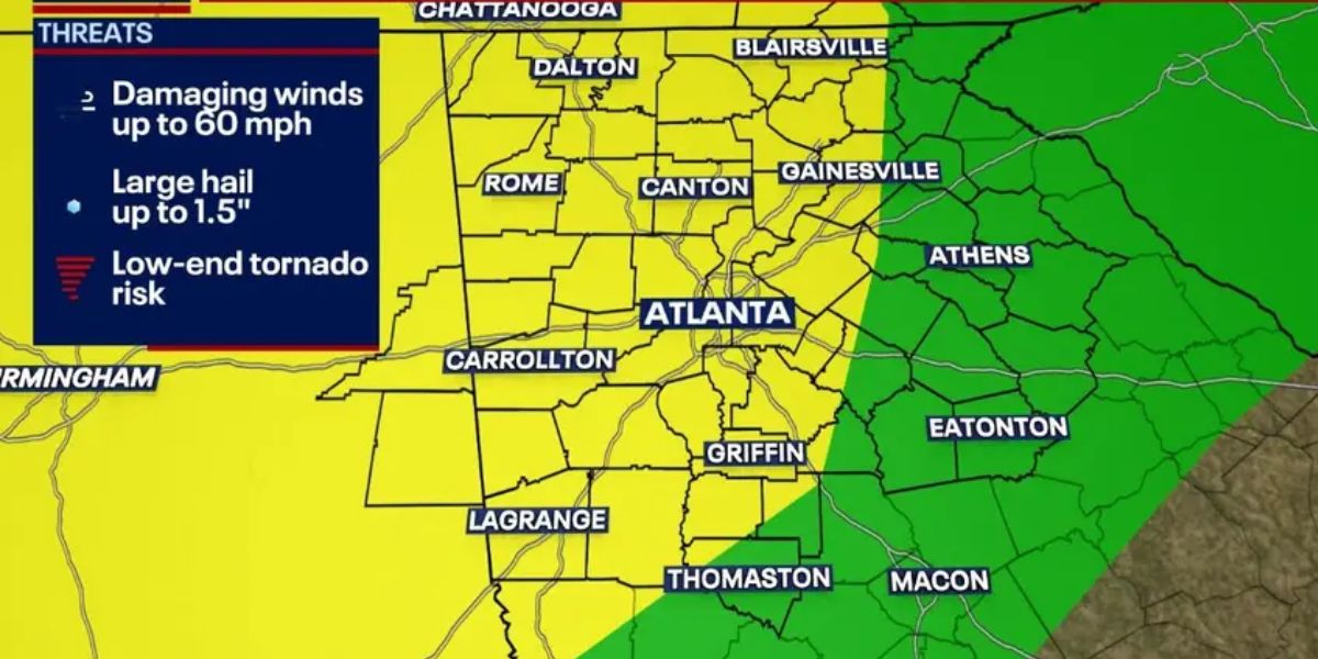
Strong wind gusts and heavy downpours are expected to roll in between the hours of 2:00 and 9:00 p.m. on Monday, causing scattered storms that might impede commutes and threaten electricity over North and Central Georgia.
It is anticipated that from Atlanta to Macon, including Rome, Gainesville, Athens, and the adjacent areas, there will be intense rains, frequent lightning, and damaging gusts of up to sixty miles per hour, as stated by the National Weather Service in Peachtree City.
Forecasters warn that even isolated storms could produce toppled trees, brief power outages, and dangerous driving conditions.
The local threat level is still at 1, but forecasters caution that even isolated storms might cause these things.
Especially during the late afternoon rush hour, major roadways such as Interstate 75, Interstate 20, and Interstate 285 could see water ponding and sudden gusts of wind. In addition, residents of LaGrange, Warner Robins, and Dublin should remain vigilant for the possibility of lightning and hail of a minute size.
Lightning strikes are always a risk, particularly when they occur outside or in close proximity to towering trees, even when the risk of tornadoes and huge hail is minimal.
Read Also: Storms Knock Out Power to Thousands in Northern, Eastern Kentucky
Officials in Georgia are urging residents to avoid traveling during the most intense storms, to secure anything that are kept outside, and to keep their electronic gadgets charged in case there is a power outage.
This set of storms occurs at a time when a heat wave is still going strong, which increases the likelihood of sudden changes in the weather.
At nine o’clock, the chance of severe weather will begin to decrease; however, more advisories and updates may be issued if the storms become more intense or if they change. To obtain the most recent information, make sure to stay tuned to local warnings and NWS Atlanta.


