The 2025 hurricane season may be getting into full swing in the next days, according to signals sent out across the Atlantic Ocean, but the National Hurricane Center has taken notice of a disturbance that is a little closer to the United States.
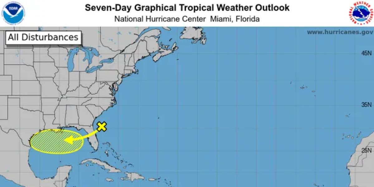
A low pressure region off Northeast Florida was highlighted by the hurricane center in a July 22 bulletin as having some potential to develop after it moves over Florida and into the Gulf of America, which was renamed from the Gulf of Mexico, later that week.
According to a hurricane center bulletin from hurricane specialist Philippe Papin, the system is expected to proceed west-southwest into the north-central Gulf where it may face conditions that may allow for some gradual growth provided it stayed far enough from shore.
According to Papin’s forecast, the system is expected to move inland by the weekend, with a mere 10% chance of development over seven days.
In any case, forecasters predict that the northern Gulf Coast will see several more days of intense rain.
“Expect rain and storm chances to increase towards the end of the week as this disturbance moves in, though it’s too early to say much with certainty beyond that,” the Houston National Weather Service office wrote on social media. According to the meteorological service in Lake Charles, Louisiana, by the afternoon of July 24, the air’s moisture content is predicted to reach its highest level.
A deja vu moment?
If the tropical forecast map from the hurricane center appears familiar, it’s because two such situations have occurred in recent weeks. A low pressure system near the southeast coast of the United States gave rise to Tropical Storm Chantal on July 5. Chantal was held accountable for at least six fatalities and caused floods in several areas of North Carolina.
The hurricane center then began monitoring a second possible low pressure region off the southeast coast on July 12.
On July 15, it slogged across the Florida peninsula with heavy rain, and on July 15, it moved down the Panhandle of the state. On July 17, it moved over southeast Louisiana while remaining disorganized.
Phil Klotzbach, a research scientist and co-author of a seasonal projection from Colorado State University, said Chantal was a little early than usual for the season’s third named storm. August 3 is typically when the third named storm of the Atlantic hurricane season originates.
Read Also: Weekly Forecast: Rainy Conditions Likely Across Emmet County
Although the 2025 season may appear to be off to a slow start given all the seasonal outlooks that indicate a busy season, hurricane specialists don’t anticipate a quiet season.
Hurricane expert Michael Lowry reported on his Substack blog on July 22 that ocean temperatures are warming more than is often predicted in the “main development region,” a section of the Atlantic known for its tendency to produce some of the worst storms.
In July, the region’s sea surface temperatures increased significantly. Any possible storm systems that develop in the area may be fueled in part by warmer waters.
Lowry attributes the present Atlantic warming to a weakening of the Bermuda High, a high pressure system that greatly affects storm movement and extends and contracts over the western Atlantic.


