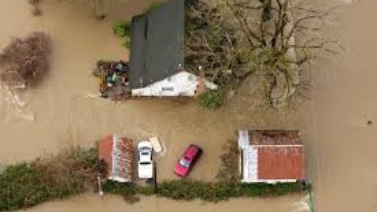
Olympia, WA – Washington state is grappling with record-breaking flooding after days of intense rainfall pushed multiple rivers to major and historic flood stages, prompting Governor Bob Ferguson to declare a statewide emergency. Officials warn that as many as 100,000 residents could ultimately face evacuation orders as floodwaters continue to impact communities across western Washington.
Emergency crews, local governments, and weather officials are now focused on evacuations, river monitoring, and public safety, as some waterways remain at or near record levels even as rainfall begins to ease.
Governor Declares Emergency as Flood Risk Grows
Governor Ferguson issued the emergency declaration amid rapidly worsening flood conditions, stating that the scale of flooding could displace tens of thousands of residents.
Officials have emphasized that evacuation orders may expand quickly depending on river behavior, infrastructure stress, and additional rainfall expected early next week. Residents in flood-prone areas are being urged to stay alert and follow local emergency instructions.
Evacuation Orders Being Closely Monitored
Local authorities and emergency broadcasters are actively tracking evacuation orders across multiple counties. The areas currently under heightened watch include:
- Pierce County
- Skagit County
- Snohomish County
- Whatcom County
Residents are advised to monitor county emergency alerts, local law enforcement updates, and official shelter information, as conditions can change rapidly overnight.
Rivers at Major to Record Flood Stage
While rainfall is expected to taper off tonight, many rivers remain in major or record flood stage, with floodwaters slow to recede due to saturated ground and upstream runoff.
Key river conditions include:
- Nooksack River at Ferndale: Cresting late this evening, possibly just shy of record levels
- Skagit River at Mount Vernon: Expected to crest about half a foot above the 1990 record around 4 a.m. Friday, remaining in flood stage into Friday evening
- Snohomish River near Monroe: Crested around 8 p.m. Thursday, slowly falling into Friday
- Snohomish River at Snohomish: Holding near record flood level through 7 a.m. Friday, then gradually receding
- Snoqualmie River near Carnation: Crested earlier Thursday afternoon, falling below flood stage by Friday morning
- Cedar River at Renton: Cresting at record flood stage around 4 a.m. Friday, expected to stay in flood stage into early next week due to controlled releases from Chester Morse Lake
- Wenatchee River at Peshastin: Cresting late Thursday evening and falling out of flood stage Friday morning
Officials note that while all rivers are expected to fall into the weekend, some will recede much more slowly than others.
Forecast: What Residents Can Expect Next
Meteorologists report that rainfall will taper off tonight, with only light showers or sprinkles possible early Friday. No significant additional precipitation is expected through Friday evening.
Friday is expected to be drier, with the possibility of afternoon sunshine. Saturday should bring mild conditions, morning clouds, patchy fog, and more afternoon sun. High temperatures will hover in the 50s, offering a brief break from the stormy pattern.
However, the reprieve will be short-lived.
Another Atmospheric River Expected Next Week
Rain showers are forecast to return on Sunday, followed by another atmospheric river system impacting Washington on Monday and Tuesday.
While forecasters say this next system will be weak to moderate and nothing comparable to the current flooding event, the impacts could still be serious due to already saturated conditions.
Expected rainfall totals include:
- 1–2 inches in lowland areas
- 4–7 inches in mountain regions
With rivers already running high and soil unable to absorb much additional water, river levels are expected to rise again into Tuesday and Wednesday.
Rivers of Greatest Concern Going Forward
According to forecasters, the Skagit and Snoqualmie rivers may present the greatest concern during the next storm system. While projected peaks are expected to reach moderate flood stage, officials stress that these levels are not expected to approach the record flooding currently being observed.
Emergency planners are nevertheless preparing for renewed flooding impacts, especially in low-lying and previously affected areas.
Possible Shift Toward Cooler Weather
Looking ahead, meteorologists indicate that late next week could bring cooler temperatures, which may allow mountain precipitation to fall as snow instead of rain. This shift could help reduce flood risk in higher elevations, though river levels may take time to stabilize.
Stay Alert and Prepared
Authorities continue to urge residents in flood-prone areas to prepare for potential evacuations, avoid flooded roadways, and monitor official updates closely as conditions evolve.
If you are affected by the flooding or under an evacuation order, share your experience and local updates in the comments below.


